
What is spatial data?
Broadly speaking, spatial data is data with a spatial reference that assigns a unique position in a defined numerical spatial reference system, for example the longitude and latitude, to any attribute or property. Spatial data is used to represent the position, shape, size, or property of an object on a map, such as a city, road, mountain, or any other point of interest (POI). While this spatial data used to be primarily recorded on analog maps, spatial data today is processed and provided digitally.
Copyright: 2023 PTV Logistics GmbH
Which kinds of spatial data are there?
Spatial data is divided into geographical data and demographic data:
- Geographical data contains geographical properties, attributes or positions such as street networks, territory boundaries and address directories, but also aerial imagery, topography data or elevation models.
- Demographic data is understood to be data with spatial reference which provides insights into the population, its purchasing power, economic activities and similar.
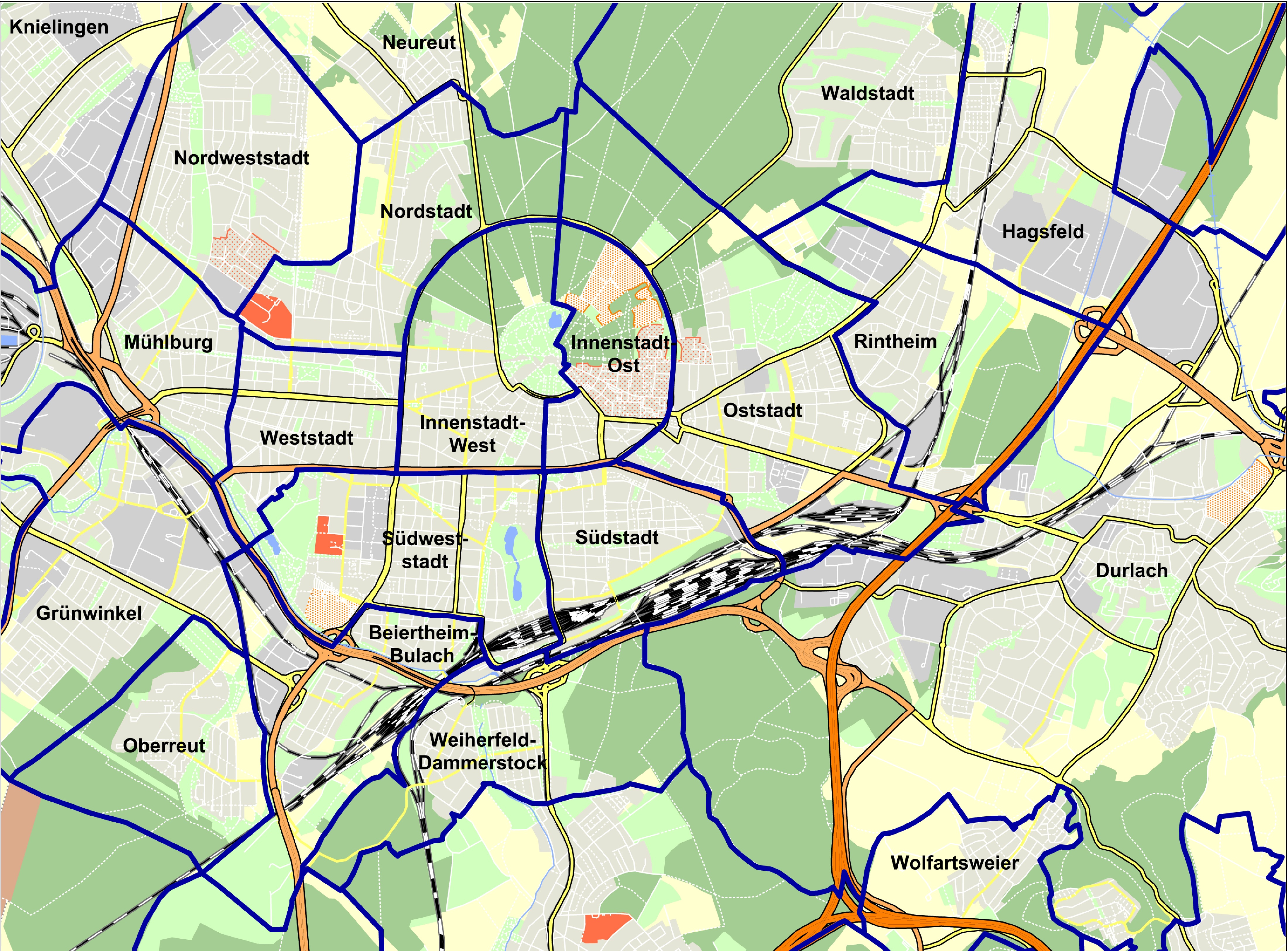
Another way to distinguish between raster data and vector data is more related to the way in which the spatial references are represented: While raster data is laid out as bitmaps in a fixed matrix, vector data consists of points, lines and polygons with geographic positions and shapes which are determined by coordinates.
Copyright: 2023 PTV Logistics GmbH / GeoJunxion
How is spatial data used or applied?
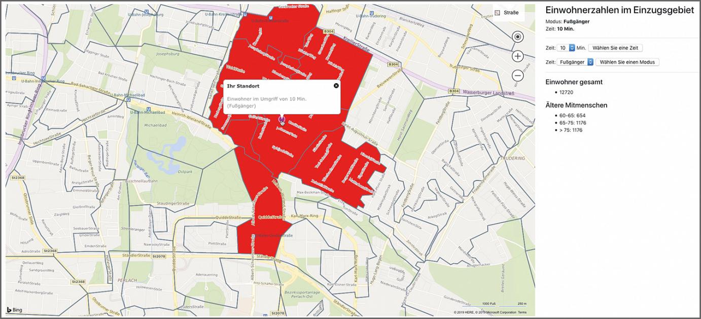
Spatial data is typically used in a GIS, a geographical information system. Companies or organizations can use a GIS to add a spatial reference to all kinds of company, market or customer data and thus create analyses, forecasts, models and visualizations.
However, there is also a whole range of spatial data that can be used in stand-alone solutions without their own GIS, such as route distances for determining distances or the geographic coordinates of postal addresses.
Copyright: 2022 Bing Maps
What is GIS?
GIS stands for geographical information system or also geo-information system.
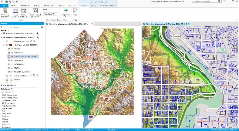
A GIS is a system for generating, changing, analyzing and displaying all kinds of geographical or spatial data. GISs enable complex spatial operations and visualizations which are difficult or impossible to carry out using other tools.
A geographical information system is a database which manages certain data. This includes objects which have a spatial reference, for example rivers, streets, forest areas, borders, buildings and much more. At the same time, the acquisition of this spatial data and its relationship to other spatial objects results in new data from which the geographic information system can generate further use.
A GIS is primarily used to better examine questions with a geographical background or starting point. The GIS helps different patterns, relationships or even facts to be identified, so that companies and organizations can better understand their own data, enabling them to be able to make well-founded decisions. However, GISs are not only used in the fields of geology or education and research, but also by trade, industry and health care services and even local governments, agriculture, transportation and logistics, right up to drainage systems or supply and refuse services. Many different sectors benefit from GISs, as they are essentially concerned with the exchange of information and cooperation.
The beginnings of the GIS can be traced back to the 1960s at Harvard University in the USA. While it used to consist of thematic maps which were created using symbols printed on top of each other, the first commercial product was launched at the end of 1970 to the start of 1980. New, more advanced geographic information systems began emerging with the increasing availability of personal computers in the 1990s. Today’s GISs are primarily concerned with GIS web applications.
Copyright: 2022 Pitney Bowes
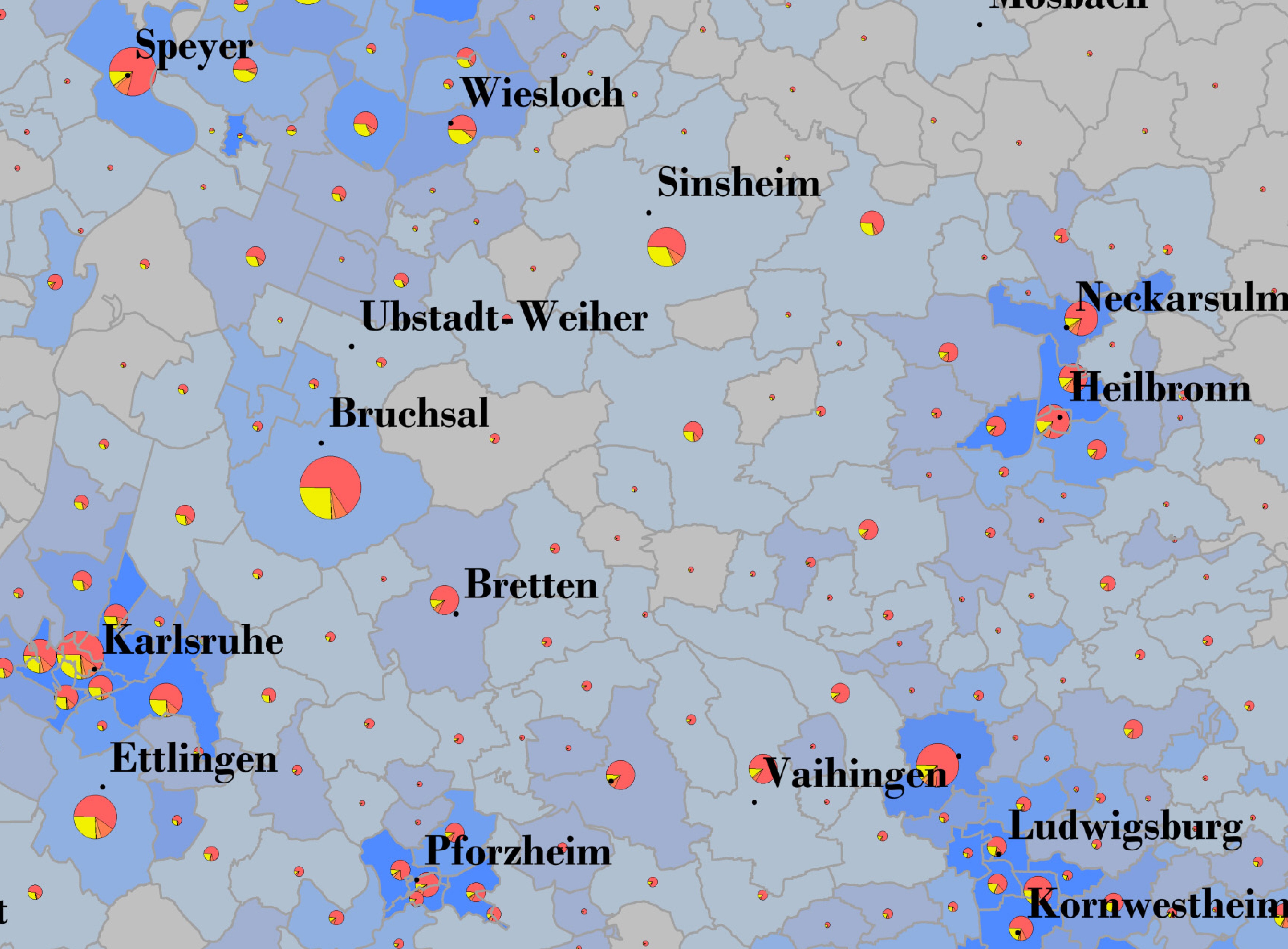
Copyright: 2023 PTV Logistics GmbH / microm GmbH
What does a GIS do?
In concrete terms, a GIS can be thought of as more than a system for cartography. It is a system of input and processing which converts primary data into secondary data. For example, it captures satellite images, maps, aerial imagery and geospatial base data and saves them. This primary data is, in turn, first organized and analyzed in order to be converted and visualized as specialist spatial data in maps, tables, texts and graphics. The secondary data obtained in this way can be filtered, shown and hidden or combined as required in various layers of information. Users of such a GIS can program their own individual functions and thus design specific solutions with the help of a GIS. A geographical information system allows connections and relationships to become visible. These are hard to identify or can only be recognized at a late stage when using simple tables. For this reason, decision-making processes are not only made easier with this interdisciplinary tool, they are also made more efficient.
A wide range of departments within a company profit significantly from such GIS software, for example marketing and sales, controlling, location management and corporate management. In geomarketing, existing data such as customer data, sales, locations or KPIs is used and linked to external data such as demography or demand level. Let’s assume a company is planning to open five new branches: A GIS can calculate which locations have the highest potential, for example based on conurbation areas or competition, and visualizes these five branches. Note that the quality of the analysis here is dependent on the quality of the data being used.
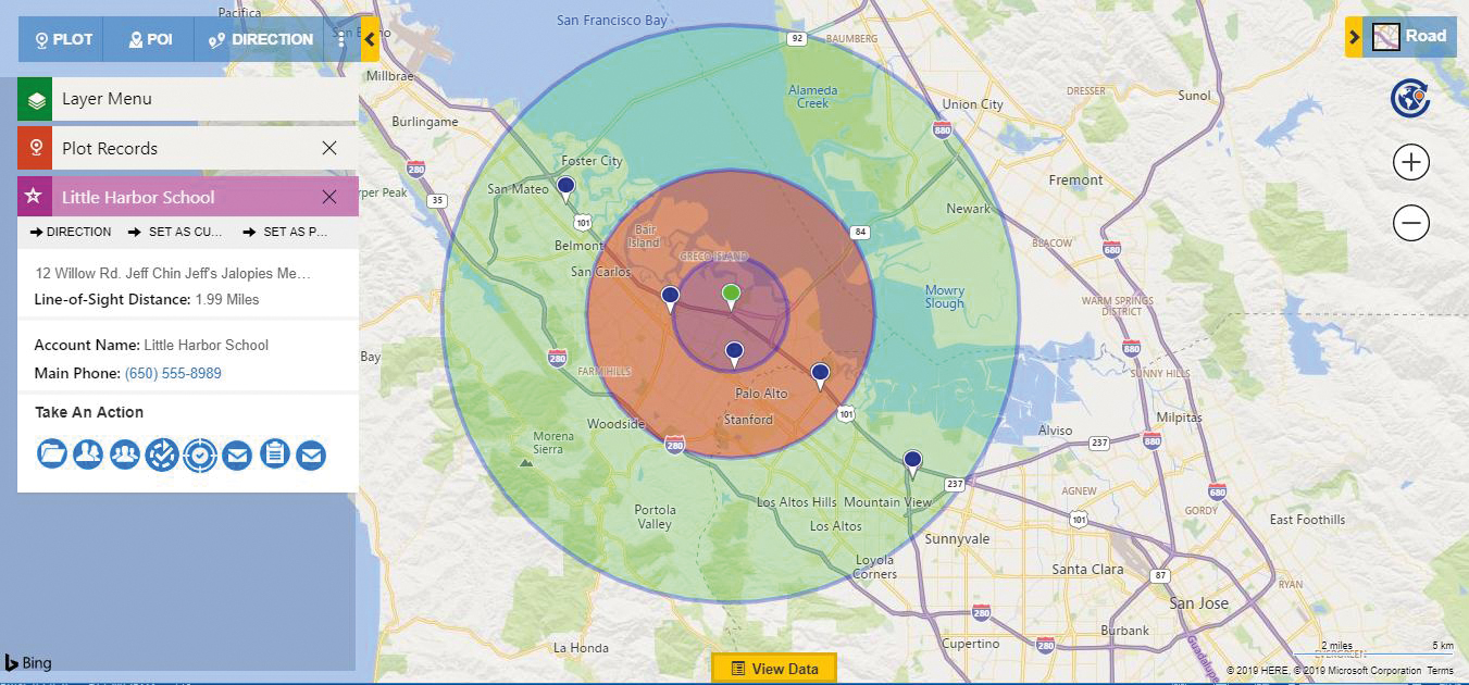
Copyright: 2022 Bing Maps / HERE
What is geocoding?
Geocoding is the process of generating geographical coordinates for any kind of location. The generated data can then be used, for example, to create map displays containing all address data or to transfer route planning to a navigation system. In this way, geocoded customer locations can be used to determine information such as relevant conurbation areas or marketing strategies.
Geocoding is generally divided into three different types: address geocoding, reverse geocoding and batch geocoding. Address geocoding involves using company addresses for various analyses. The generated addresses can be used for market analyses, demand level analyses, analyses of location or also geomarketing, to name just a few. The supply chain, locations and customers are also visualized. Reverse geocoding is the same but in reverse: Addresses are generated using coordinates. And last but not least, batch geocoding, is preferred by companies as it automatically adds addresses to the system at the same time, rather than one at a time. So batch geocoding means that you save time and increase efficiency.
Geocoding addresses has significant advantages for customers: It can be used not only to efficiently acquire new customers, but also to find where new locations for additional branches are needed, to identify and analyze where the competition or significant points of interest are located, or to determine ideal warehouses and other locations within the supply chain.
How can spatial data be managed and quality ensured?
In times of open-source solutions, it is often advisable for private and non-commercial requirements to use spatial data that is available free of charge and in rapidly growing volumes.
However, as soon as corporate processes are reliant on the quality of the data, licensed spatial data specific to the desired use case should always be purchased. In this case, it is better to purchase the data either directly from the producer or from a licensed contractual partner. Unlike in the case of free trade, this ensures that users and developers alike always have access to the latest available data.
There is also the legal aspect: If data is used beyond the scope of the purchased license, this can result in severe additional charges or even contractual penalties. In the interest of a good and long-term customer relationship, contractual partners or the data producers themselves, provide detailed advice on the most suitable licensing variant in each individual case.
Where is spatial data available?
A great deal of spatial data is generally available free of charge, either through open-source platforms such as OpenStreetMap or through public providers such as geoportal.de. When it comes to private use in particular, much of this data can definitely be recommended.
However, when spatial data is being used professionally in companies, this free data is not always suitable, as there are often licensing or usage restrictions for commercial applications or the data cannot be combined with other corporate data. There are various providers of professional map applications such as Bing Maps, HERE maps or Google, who charge to make spatial data available via API, but there are also a number of data providers who offer specific spatial data such as traffic data or household-related data. In this case, it makes sense to obtain spatial data from professional providers such as PTV Logistics GmbH, as in addition to the data itself, they also offer professional advice on use and application possibilities, suitable software, scalability or integration into the corporate platform.
How is spatial data used in the corporate environment?
When it comes to spatial data in the corporate environment, business intelligence solutions are being increasingly used. They enable the aggregation of all corporate data with a spatial reference and a wide range of additional information such as market data or traffic flows.
Even though the trend is moving towards cloud applications, many companies are still successfully using GIS solutions in their in-house systems today.
The possible use cases for spatial data are manifold; here are a few examples:
- Geomarketing: Here, purchasing power data at a household level is used in particular, but also a wide range of demographic and socio-economic data.
- Territory or location planning: When it comes to location analysis and evaluation, regional or local economic structures often play a role which is as significant as socio-demographic factors.
- Trip and fleet planning: Data on traffic flows provides valuable information for trip planning within fleet management and for traffic planning, but also for outdoor advertising and other marketing purposes.
- Market analyses: Here, grid data or also raster data is particularly suitable for market analyses and for the generation of derived data.
-
Business intelligence: Extension of business intelligence data to include spatial reference in order for corporate data, for example customer data, branch locations or sales networks to be assigned geographically and clearly visualized, even without knowledge of programming.
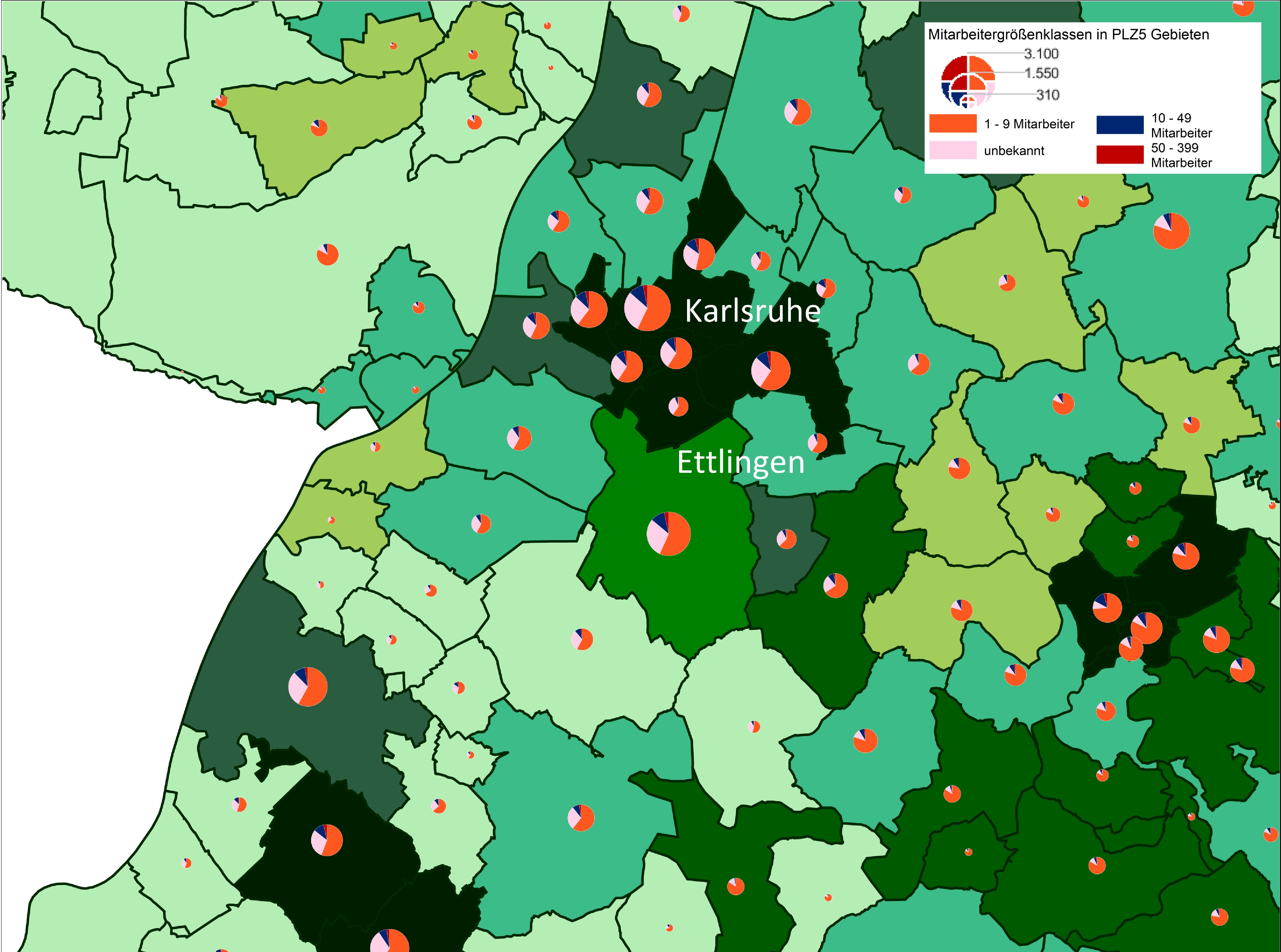
Copyright: 2023 PTV Logistics GmbH / microm GmbH
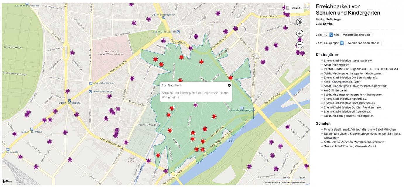
Copyright: 2022 Bing Maps
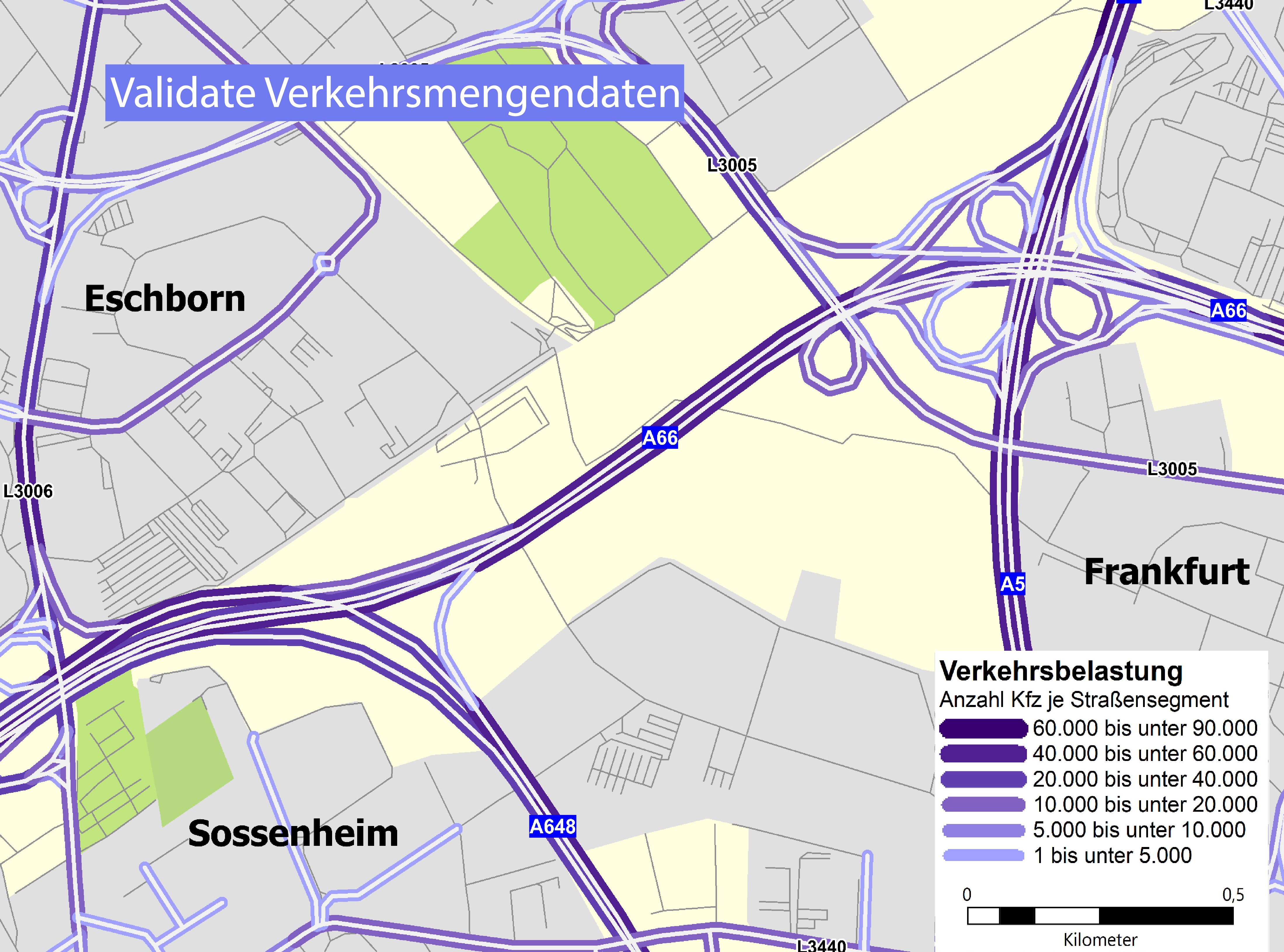
Example of spatial data in traffic
Spatial data in traffic supports you in managing your company’s fleet, assessing traffic flows for targeted outdoor advertising and also route planning, or processing traffic networks all over the world in order to plan or visualize them.
A well-known example is the distance tables PTV Entfernungswerk Straße (EWS), which allow transportation companies to not only calculate the distance in kilometers between any location but can also show any toll charges that might occur at the push of a button. Using a GIS, these values can then be directly incorporated into freight calculations which means that quotes can be generated automatically.
A further key example is the Smart Monitoring Ecosystem SME data analysis in cities. With the help of real-time analyses from spatial data, an advisable solution can be visualized for municipalities and cities, raising the satisfaction of their citizens at the same time. This means that, for example, shared mobility vehicles which are incorrectly placed or are in the way and are therefore causing a hazard, can be recognized and recorded. These include e-scooters, electric motor scooters and e-bikes. With the help of an SME, these vehicles can be automatically reported to the authorities, who are then able to ensure better safety.
Copyright: 2023 PTV Logistics GmbH
Any questions? We are here for you!
Do you want to find out more about the PTV Logistics world of data? Get in touch with our team of experts using the online form or simply give us a call at:
Phone +49 721 91112-400

